

Land Development
Panoramia controls a vast extension of raw terrain located in Caracas and within the expansion area of the city.
Key Competitive Advantage
Panoramia’s land holdings enable the company to develop its own projects across multiple use categories, controlling the full value chain from raw land to finished development.
This vertical integration reduces dependency on third-party landowners and maximizes returns at every stage of the development cycle.
- 01
City Expansion Zone
Strategic location
- 02
Multiple Use Categories
Residential · Commercial · Mixed-use
Residential
Commercial
Mixed-use
Strategic Positioning
Caracas Metropolitan Area
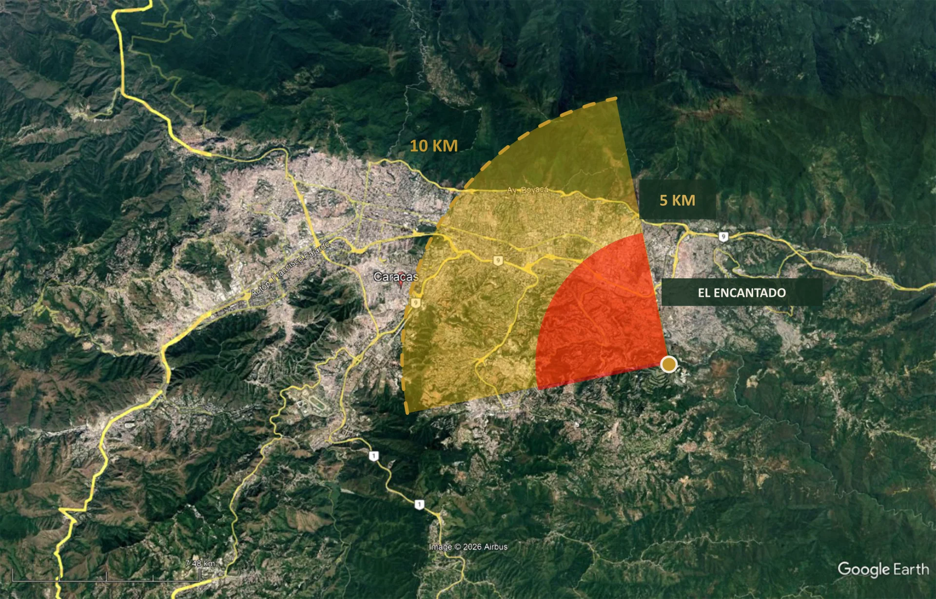
Satellite view of the Greater Caracas area, spanning from Catia in the west to Petare in the east — the city’s full urban corridor along the Guaire valley.
El Encantado, marked on the map, sits at a key inflection point at the southeastern edge of the metropolitan area, where the city transitions into the expansion zone toward the Tuy valleys.
The quarter-circle overlays illustrate the reach of Panoramia’s land holdings:
5 KM RADIUS / 10 min drive
Immediate development zone — covers the core urban periphery and primary access routes.
10 KM RADIUS / 20 min drive
Extended reach — encompasses secondary growth corridors and future expansion territory.
100% Owned Land Within Expansion Zone
Full value-chain control from raw terrain to developed properties.